CONOR KINGSTON
Work Samples

This is a screenshot showing the groundwater levels in an area with 2 pumping wells and a recharge well, with a no flow boundary on the lefthand side and a fluctuating lake on the right hand side. This was a model I wrote in Matlab to get a flow field for this area.

This is the results of stream gauging Clear Creek in Golden CO. The orange represents the flow-rate of the stream and the blue is the stream profile.
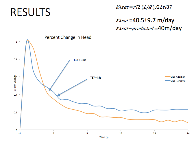
I performed a slug test on an observation well in an active landslide on I70 in Colorado to confirm hydraulic conductivities that were found by calibrating a model. The measured value helped to confirm the model output and the conceptual model of the landslide.
This is a screenshot showing the groundwater levels in an area with 2 pumping wells and a recharge well, with a no flow boundary on the lefthand side and a fluctuating lake on the right hand side. This was a model I wrote in Matlab to get a flow field for this area.